vMAP Portal makes it possible to explore natural resources online using the power of a full-featured web GIS software , offering valuable insights into priority areas regardless of industry. Reduce risks and gain perspective by identifying environmental trends within selected areas as well as track environmental impacts, resource allocation and policies. Our GIS tools encompass a range of fields, unlocking powerful project assessment with specific data visualisations.
Explore natural resources with vMAP
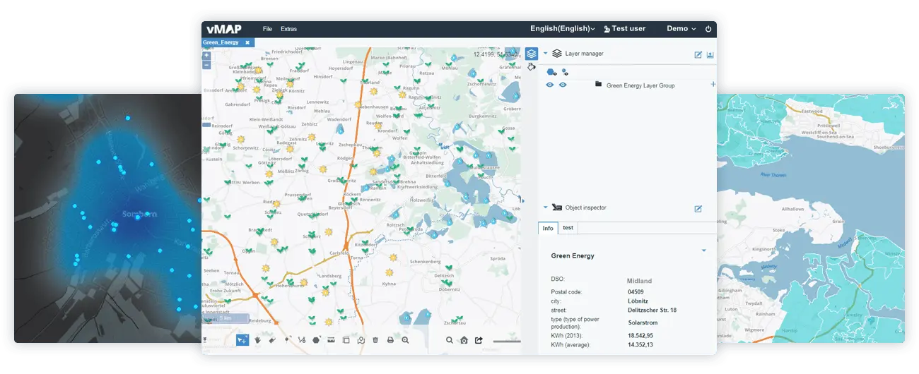
Explore the world of natural resources with vMAP
Key features that improve your operations
Custom Styles & Interactions
Customise icons, images and functions as desired, and fully customise and display map data.
Data Integration
Easily import and export data between vMAP and other systems.
Multi-Level User Rights
Define user rights at every level with specific function and content allowance to the same data.
Reports & Presentation
Generate customisable reports with defined data, templates and formats.
On-Premise & Online
Access via cloud-based solutions or install vMAP on private servers.
Various Basemaps
Multi-clickable basemaps in your vMAP dashboard provide a multi-contextual foundation for viewing your geospatial data.
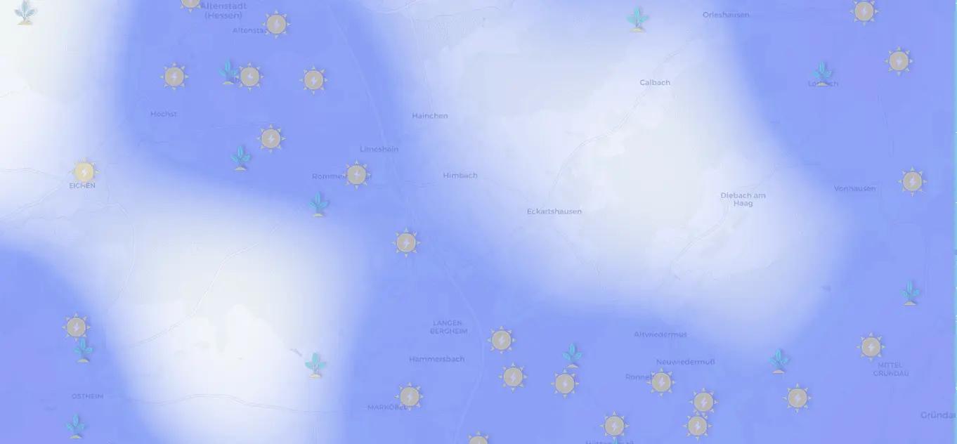
Visualised Exploration
Compare real-time monitoring of your data against historic and geographic datasets to visualise key elements of change within your specified view. Track changes in resources, land information, facilities, equipment and activities, using visualised data to enforce your crucial decisions in managing and sustaining the earth’s resources.
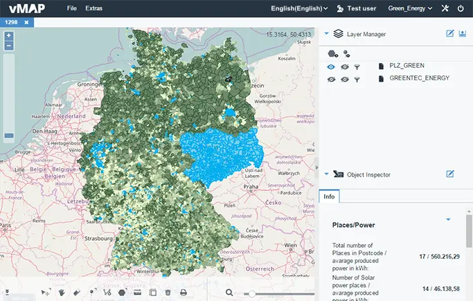

Mapping Resource Data
Map the reserves and development of natural resources.

Real-Time Monitoring
Monitor real-time data following equipment, vehicles, facilities and crews.
Data Analysis & Assessment
Use vMAP to confidently analyse all resource data, compare values, conduct research and evaluate conditions.

Analysis
Overlap layers from different time periods and categories to reveal patterns and trends.

Comparison
Compare data on different areas, categories, conditions and dates within a single customisable and interactive map.

Filter Your Information
Quickly discover and present different data categories by setting multiple conditions.
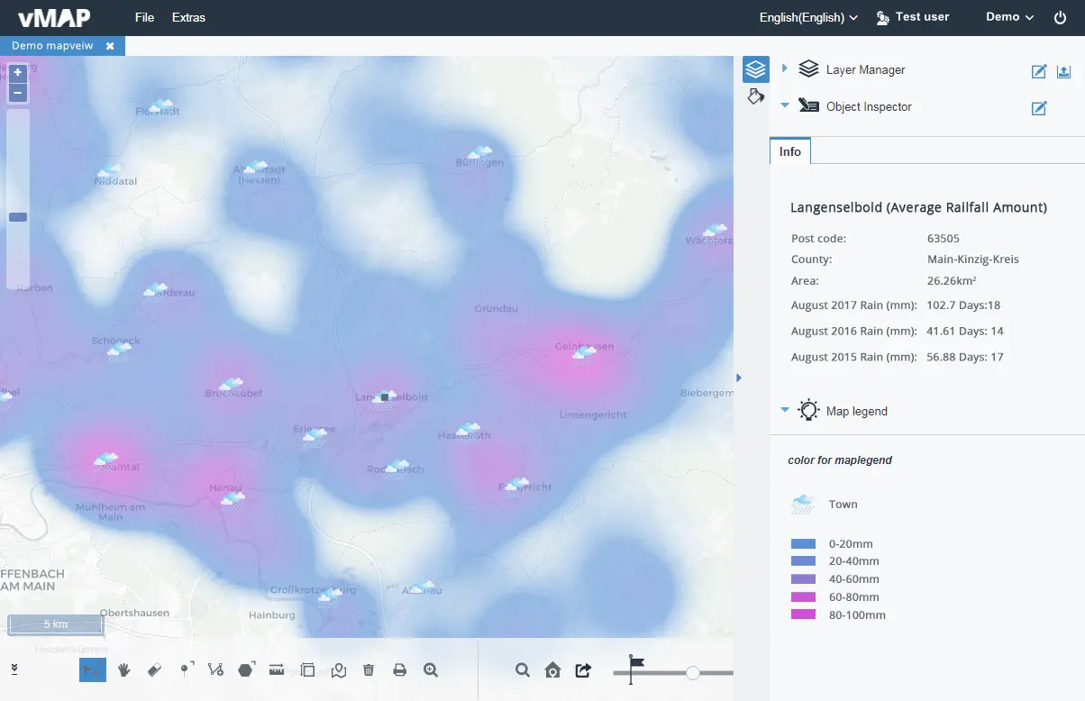
Climate Monitor
vMAP finds sustainable solutions based on your data, identifying trends and impacts and displaying them to your needs. Filter important climate issues to more easily pinpoint climate shifts, understand when and where change is occurring, and its potential risks. Understand and predict these changes with a degree of accuracy using our powerful GIS tools, then share and collaborate on the detailed view of natural resource developments provided by your data.

Accurate Location
By importing data into vMAP, you can visualise and analyse target areas to extract useful climate data and in real-time spot precise locations for natural resource exploration.

Minimise Risks & Damages
Reduce climate damages with advanced predictive functionality and recommended precautions using vMAP’s visualised climate warnings.

Climate Assessment
vMAP regional analysis can improve the accuracy of your climate assessments and future studies into climate changes.
Management
Keeping track of your projects and users has never been simpler. With vMAP GIS tools you can efficiently manage your company or group, easily regulate user authority, unify useful information, and enable access to rich map data.

Powerful Reporting
Use customisable templates to gather and present vital information in a visually appealing way. Analyse multiple data sources in a geographic context using engaging visual reports that can be easily saved, edited, exported and shared.

Data Integration
You can integrate vMAP with your existing solutions using its powerful API and supported rich data formats. Prepare for climate changes and natural resource exploration within set timescales and deliver a reliable service.

User Management
Multi-level rights management in vMAP can be used to allocate different functions and data clearance to different users, such as researchers and exploration teams, so multiple users can work on the same data at the same time yet with individual content rights.

Flexible Map Access
Run analysis on your own infrastructure and enjoy flexible access via both internal and cloud-based networks.