analysis

Analysis

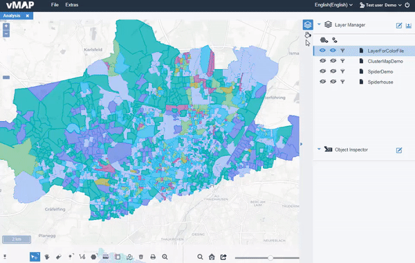
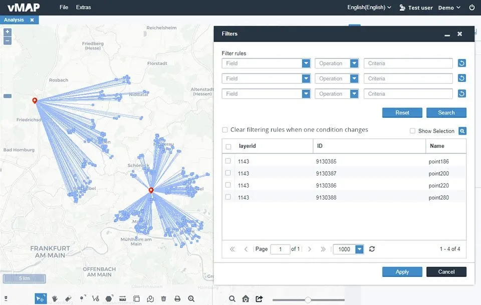
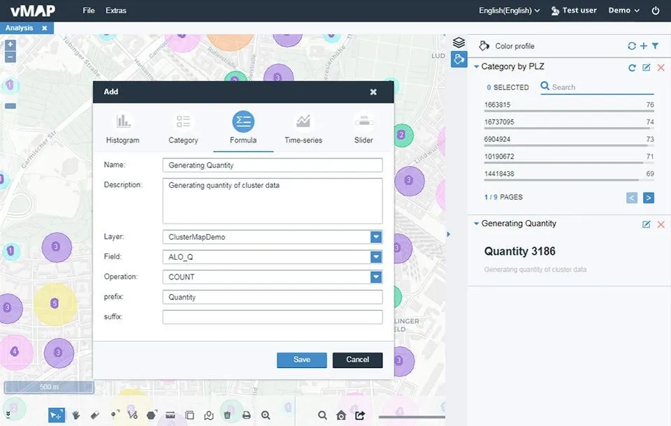
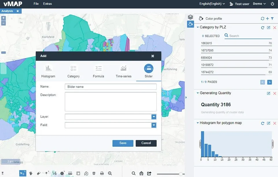
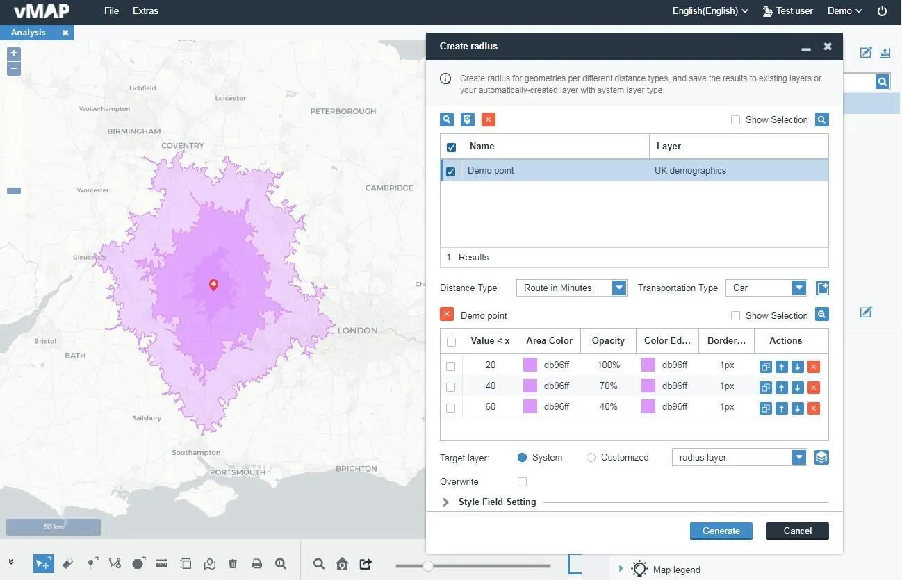
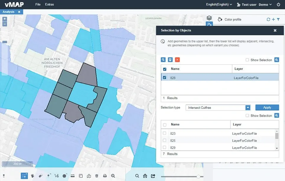
Spatial analysis is widely applied in the geo-industries field. For example, opening a retail store requires the collection, storage, analysis and display of extensive spatial data. Demographics, passenger flow, transport access, competitor locations, and nearby land use that may restrict business must be considered. vMAP GIS software brings complex data analysis to life, transforming traditional spreadsheets into intuitive visual maps.

 analysis

The result is a powerful visual representation of key data, info, sites and markets. vMAP’s Mapview can be used to easily visualise and interpret trends and relationships within specified areas.

vMAP’s geoprocessing tools, algorithms and models help you determine the best possible locations. Perceive trends and patterns with maps, charts, histograms and more for faster, more powerful decision making.

 Filter

Data Filtering

View only the data you need with Mapview filter criteria. Each Mapview can have up to three filter criteria and all value fields can be filtered. Choose from the following operations:

  • Greater than
  • Less than
  • Equals
  • Include
  • Does not include
  • Greater than or equal to
  • Less than or equal to
 Filter
 Data Calculation

Data Calculation

vMAP’s Formula tool calculates the value of any chosen field and displays the results on the Mapview panel. The calculation occurs simultaneously when changing any dynamic filter. Choose from the following calculations:

  • Count
  • Sum
  • Average
  • Max
  • Min
 Data Calculation
 Dynamic Rendering

Dynamic Rendering

vMAP Dynamic Filtering enables users to view map data with greater flexibility than common GIS software filtering. Control Mapview content (including points, polygons, heatmap areas and spider maps) in real-time by clicking and dragging dynamic filters. The filters are based on Color profile settings.

 Dynamic Rendering
 Histogram

Histogram

Click and drag the Histogram to filter all data by user-defined interval.

 Time Series

Time Series

Filter all field data by time value range (minutes, hours, days, weeks, months, quarterly, yearly).

 slider

Slider

Filter data with one field value as the range by clicking and dragging the progress bar.

 Category

Category

Filter any data field with that one field as the category.

 Creating Areas

Creating Areas

vMAP GIS tools generates bubble maps (circular areas) and isochrone maps (equal travel time areas) by a range of parameters for optimal regional analysis. This capability to create and visualise areas of influence makes these map types perfect in hydrology, residential and transport planning, and land use.

 Creating Areas
 Isochrone Map

Isochrone Map

Isochrone map parameters are radius of distance, walk-time or drive-time. Additional custom conditions can also be set.

analysis

Bubble Map

Bubble map parameters include Mapview’s configurable radius, color and opacity values.

 Various Search Types

Various Search Types

Searching data in vMAP is simple and intuitive. vMAP offers various search types so it is just as simple to find the right objects via Mapview’s combined GIS and spatial data.

 Various Search Types
 select radius

Radius Search

Quickly search for and display objects (points, polygons, lines) near to the map center point within a time or distance radius. Time radius can be by walk, drive, or custom. Distance radius can be metres or kilometres.

 Attribute Search

Attribute Search

Each object may have several field values and each map layer may have hundreds of objects. Users can use attribute search to easily find target objects with specific values.

 Adjacent Search

Adjacent Search

Once any polygon is set as an original object, use vMAP’s Selection by Objects to discover all linked polygons. With search completed, linked polygons are listed in a convenient grid for further action. Values can then be viewed and changed, rendered by color and more.

 Overlapping Search

Overlapping Search

Search and display the overlapping parts of any object including point, line and polygon (similar to adjacent object search). Set one object as the original and vMAP will search all objects (point, line, polygon) that overlap the original.