Using vMAP in Pedestrian Shed Mapping
In sustainability development, urban planners are often interested in determining the walkability within urban city centers, as well as the major public facilities in it. This concept of walkability among modern city centers has become influential amidst the ever-growing demand to develop sustainable and accessible urban designs. The idea is that, to lessen the carbon footprints generated by these expanding urban centers, people should be able to walk more by making most of the facilities such as recreational areas, civic offices, and public transportation hubs more accessible. And this is where pedestrian shed analysis comes in.
What is Pedestrian Shed?
Pedestrian shed, or most commonly known as “ped shed” is what urban planners defined as the basic building blocks of walkable cities. This refers to the area or catchment that is within a walkable distance from city center or facility. Generating these ped sheds can be done in several ways. But the most common method involves measuring the areas that are within a five-minute walk from urban centers. The maps generated are also called isochrone maps depicting areas of equal travel time. Another technique involves measuring the straight-line distance from the center, as well as the network-distance which is more realistic, since it considers the actual road network distance. By generating these ped sheds, urban planners can determine comparative estimates of how easy it is to travel within the city and how they can optimize the design if necessary.
Ped Shed Mapping of Recreational Areas
Aside from measuring the accessibility of city centers, the concept of ped shed mapping can also be used in determining the accessibility of public facilities and recreational areas such as parks. Since parks are where most of social interactions happen, determining ped sheds of parks for example can help city planners identify where they can properly put up these parks considering the concept of walkability.
Let’s say you are the head of the Parks and Recreation Services Department and recently, you have been granted a fund to develop a new recreational park for your area. As a result of several consultations with various urban planners, you were able to map out the existing parks in your area. What needs to be done next is to identify the underserved areas or those areas that are not within a walkable distance from existing parks.
Using vMAP, you can easily create ped shed maps and identify these locations that you can potentially develop into a small recreational park. The Create Radius Tool in vMAP considers pedestrian distance in creating buffers from park polygons. By importing the Shapefile of existing parks on vMAP, you can easily create isochrone maps using different parameters.
- Radius in Meter – This distance type creates buffer by using straight-line distance (Euclidean distance) from the facilities (ex. within 300 meters from the parks). The resulting layer is a circular buffer showing equal distance from the parks.
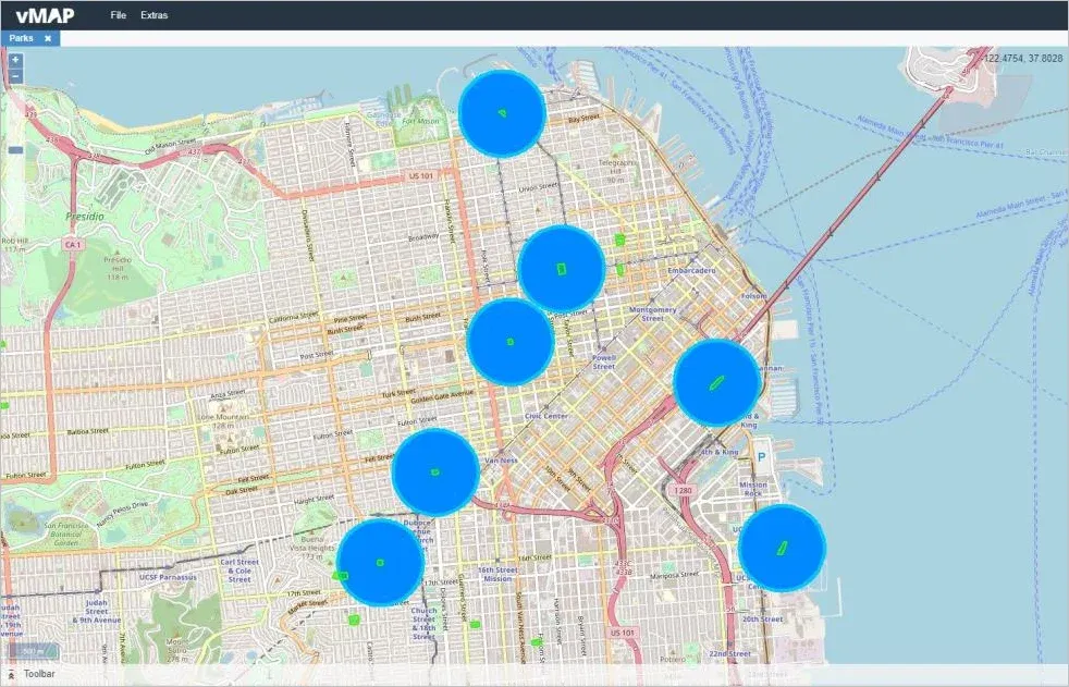
Figure 1. Generated buffers showing ped sheds that are within 300 meters from the parks.
- Route in Meter – This distance type creates buffer by using the network-distance from the facilities. The resulting layer is an irregular polygon showing the actual distance traversed using the road network.

Figure 2. Catchment areas that are within 300 meters from parks, using road network distance.
- Route in Minutes – This distance type creates a buffer by measuring the actual distance that can be traversed in a given time period from the facilities (ex. within five minutes from the parks).

Figure 3. Ped shed map showing the catchment areas that are within a five-minute (orange) and ten-minute (yellow) walking distance from parks.
To generate the areas that are within a given distance or time value from the facilities, vMAP uses several vehicle profiles, including one for pedestrians. The distance can then be measured using APIs from different established service providers such as HERE, OSM, and vMAP. In addition, users can further customize their calculations by creating their own pedestrian profile.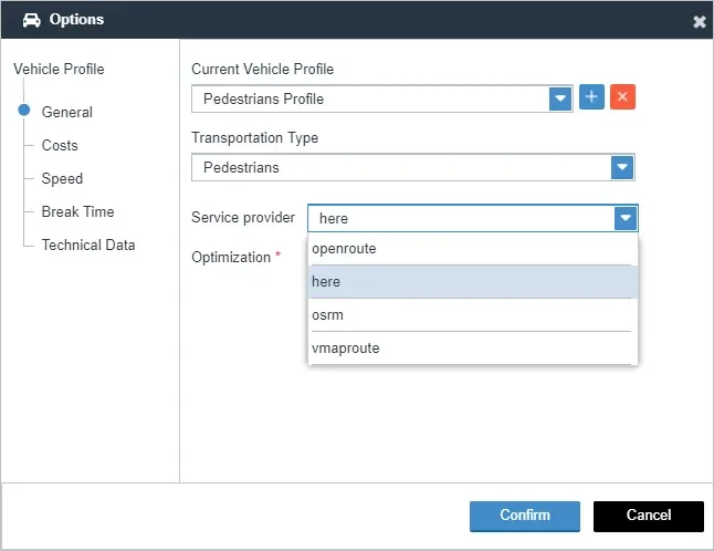
Figure 4. Different options that users can use to create a customised profile to measure pedestrian's walking distance.
vMAP provides various mapping capabilities to effortlessly create ped shed maps of recreational parks. Park managers and city planners can easily measure the accessibility of existing recreational parks in their neighborhood. Through this, they can also incorporate innovative urban designs in creating comprehensive land use plans for their cities.