Putting Your Customers on the Map
There was a time when marketers make use of a bunch of customer addresses on a sheet of paper to formulate a compelling advertising plan and eventually, sell products. Analyzing what to sell on a region or market territory seems to be a manual and laborious procedure until advertisers started to use maps. Maps have become quite a popular tool for marketers not only as a tool for visualization but more importantly, for effective marketing of consumer products.
Most businesses nowadays are collecting customer data including addresses and other relevant information. This has been a trend ever since location analytics became a thing and using maps for sales generation was deemed valuable. If you have this kind of information, you can use spatial analysis to incorporate demographics data usually taken from census such as age, race, gender, earnings, and income to a location. In doing so, marketers can then analyze spending habits and sales patterns exhibited by a group of people in that area and identify those who are likely to respond to certain product promotion.
Address Mapping
The process of converting a location description such as a postal address, or a pair of latitude and longitude to an actual location on Earth’s surface is called geocoding. Essentially, geocoding is used by Geographic Information Systems to find the exact location of an address on the map. If you want to put something on a map, geocoding is what you do.
In geomarketing, customer addresses are the most common subject of geocoding since they serve as the backbone of advertisements and product promotions. Marketers need to see where exactly they are going to launch a promotional campaign that can attract the most customers to their products. Say you know where young professionals ages 24-30 who are earning enough money to afford a car but do not own one yet are in your area. You can specifically target those areas for a sweet car deal promotion over the other areas to increase sales potential.
Geocoding in vMAP
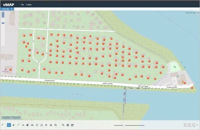
vMAP can generate geocoded addresses so customer data can be plot out on a map. Using vMAP Portal, there are a couple of ways to map out your customers from a list that is usually in a tabular format. Customer information in tabular formats such as Excel spreadsheet (XLSX) or Comma Separated Values (CSV) files can be used for geocoding addresses in vMAP.
- Coordinate Pairs
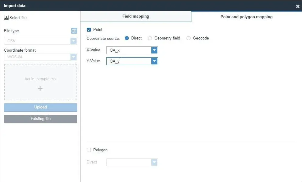
GPS devices like those that are found in your smartphones can generate values known as longitude and latitude (XY coordinates) for a particular location. This coordinate pair is essential in geocoding so if your customer data already contains this information, you can easily plot it into the map using vMAP. By specifying the fields that contain the X and Y information, vMAP processes the values and identifies its corresponding location on the Earth’s surface.
- Street Address
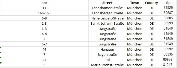
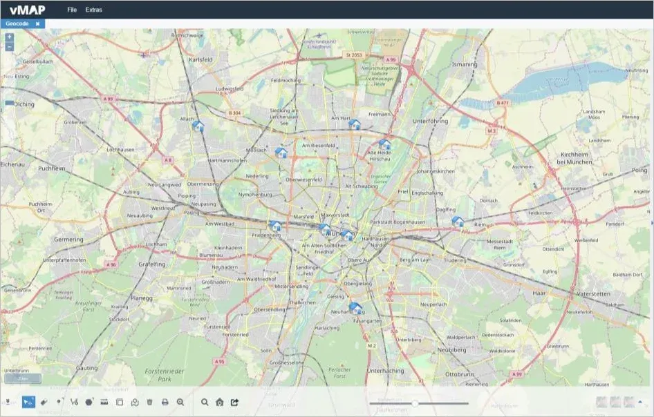
Most of the time, businesses that are just starting to use maps do not have this coordinate information yet. What they have is the usual street address format containing the house number, street name, city name, country name, and ZIP code. Only a few GIS mapping software in the market are capable of correctly geocoding addresses in this format. vMAP is one of them.
Converting your customer data from a tabular format to a map provides a much better way to visualize information. But going deeper, GIS can be used to widen your business’ reach. vMAP contains a powerful geocoding capability to help you enable the mapping component on your business. From mapping your customers, you can perform a more in-depth spatial analysis that will help you grow your business.